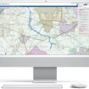
gi Perspective launches planvu 4
With such a high demand for digital engagement tools amongst today’s public, local governments’ use of online interactive mapping ...
With such a high demand for digital engagement tools amongst today’s public, local governments’ use of online interactive mapping ...
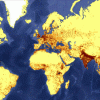
A map projection is an attempt to portray the surface of the earth onto a flat surface. It is ...
As the World analyses the commitments agreed during COP26, we look at the role of GIS in managing forest ...
Many public and private organisations hold sets of historic maps which contain a wealth of information, for example maps ...
gi Perspective provides organisations of all shapes and sizes with geographic information and digital mapping solutions, utilising our staff's breadth of experience to exceed customer expectations.