Many public and private organisations hold sets of historic maps which contain a wealth of information, for example maps or plans displaying planning policies, land ownership areas, utilities locations or indeed just about any historical geographic data. Such historic maps may have been updated by hand over the years with various amendments and notes and of course may not be in the greatest of condition. Letting old documents further deteriorate or leaving them at risk of fire or flood damage risks losing useful or even critical information.
No matter how old and dog-eared, historic paper-based map information and any associated textual records can be transformed into modern, digital data for use in Geographical Information Systems (GIS) and interactive maps.
These are the five steps that we take to get you there. For larger projects, it might be sensible to undertake a pilot exercise to inform the workflow before the process begins at volume.
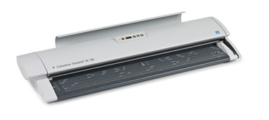
1. Scanning
The number of maps and records may seem overwhelming at first, but an efficient scanning process can be undertaken either onsite or offsite. For a recent project for the Welsh Government, we scanned many thousands of maps and registers up to A0 in size, onsite, at all 22 local authority offices.
Each time the scanner is set-up; it is calibrated, ensuring that knocks or temperature changes do not affect the overall consistency of the scanning process. Documents are then scanned in order, and the resulting scans organised into a sensible folder structure. This makes it easier to identify each scan and helps the scanning technician to ensure all documents are scanned and checked for quality and completeness.
Any documents that are not in a good condition can be placed within a large plastic polythene pocket to protect them. For onsite visits, scanned images can be transferred to a secure, encrypted hard drive for transit.
2. Scan collation
A separate process is then undertaken offsite to name each scan according to an agreed naming convention (for instance using a map tile reference). Each scan file is checked to ensure it is orientated correctly and any cropping can also be carried out during this stage.
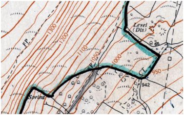
3. Georeferencing
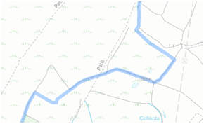
Georeferencing is the process of adding location information to each scanned map image, so that it sits in the correct place in GIS software. The addition of such location information then allows a mosaic of scans to be created which can be used to capture relevant features in real world coordinates.
4. Data capture
The process of capturing data form the scans will be different for map and non-map documents. Relevant features from the scanned maps can be geographically captured into a GIS system over modern reference base mapping, such as that available from the Ordnance Survey. The agreed project specification will describe when a feature can be ‘snapped’ to modern mapping, and when the original marking on the scan must be exactly followed. It will also describe any references or names that need attributing to the features.
Text on non-map documents will either be typed, make use of optical character recognition, or a mixture of the two. This will very much depend on whether the text was originally typed or handwritten. The text will be organised into forms, reflecting the structure of the documents, providing a searchable resource for future use.
There will also be comprehensive quality assurance steps for both types of data captured. For map data this will include topological checks (such as overlaps and gaps), whereas for textual data this will include spelling, format and completeness checks as defined in the specification.
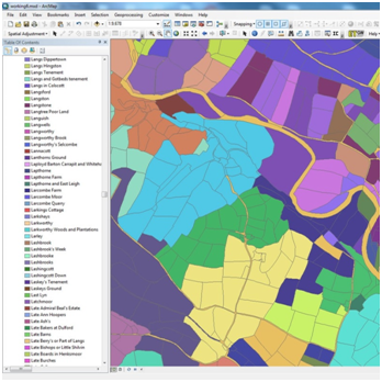
5. Database modelling
It’s likely that your data will need some kind of database structure created for use in GIS or an interactive map and there may also be a need to link textual data to geographic data, for instance though the use of references. Your modern geographic database can then be published and interrogated. It could form the basis of important research or be used as a new legal record. Whatever the purpose, a one-off investment to capture historic maps can be an invaluable process.
Comments are closed here.