GIS and Forest Loss
As the World analyses the commitments agreed during COP26, we look at the role of GIS in managing forest ...
As the World analyses the commitments agreed during COP26, we look at the role of GIS in managing forest ...
Many public and private organisations hold sets of historic maps which contain a wealth of information, for example maps ...

Geographic information is information that describes the locations of features on the Earth’s surface. A geographic information system (GIS) ...
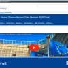
The web-based GIS portal, mapping marine and maritime data, has been renewed for a further two years
We are part ...
gi Perspective provides organisations of all shapes and sizes with geographic information and digital mapping solutions, utilising our staff's breadth of experience to exceed customer expectations.