 March 10th 2022
With such a high demand for digital engagement tools amongst today’s public, local governments’ use of online interactive mapping during the plan-making process has seen a steady rise in recent years. Such digital tools mean far less printed maps are being used for Local Plan stages, as online mapping can provide a far richer experience for those wishing to view and read up on the latest Local Plan policies in their area.
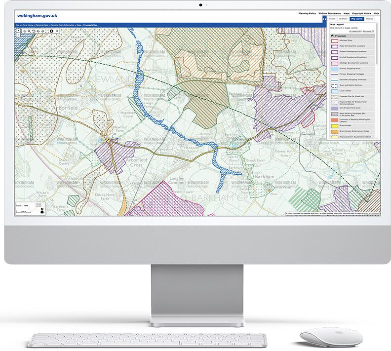
Working with hundreds of councils since the 1990s on printed Proposals Maps or Policies Maps, Lovell Johns has been providing such a digital online solution for Policies Maps publication since 2007. In late 2021, the GIS solutions arm of Lovell Johns, gi Perspective, have started to roll out the latest version of this product – planvu v4.
What is Planvu?
Planvu is a hosted Policies Map solution which facilitates increased user engagement by providing all citizens, developers and council staff with free access to intuitive online mapping information, presenting the latest Local Plan Policies Maps and associated written statement. Planvu can be updated quickly in comparison to a printed map as we hold the library of files which can be easily amended for a new policy or layer of information.
What’s new in Version 4?
- Full screen mapping, providing the user with a full screen width map for better presentation
- The ability to hide the map key and layer listing, again providing a larger map presentation
- Mobile and tablet compatibility through responsive design; the site automatically detects mobile and tablet use and so resizes and distributes content for an improved experience
- Accessibility compliance through updated HTML mark up and improved keyboard naviagtion
- An auto-complete on the location search feature where suggested matches help the user when searching for an address
- Speed improvements across the site
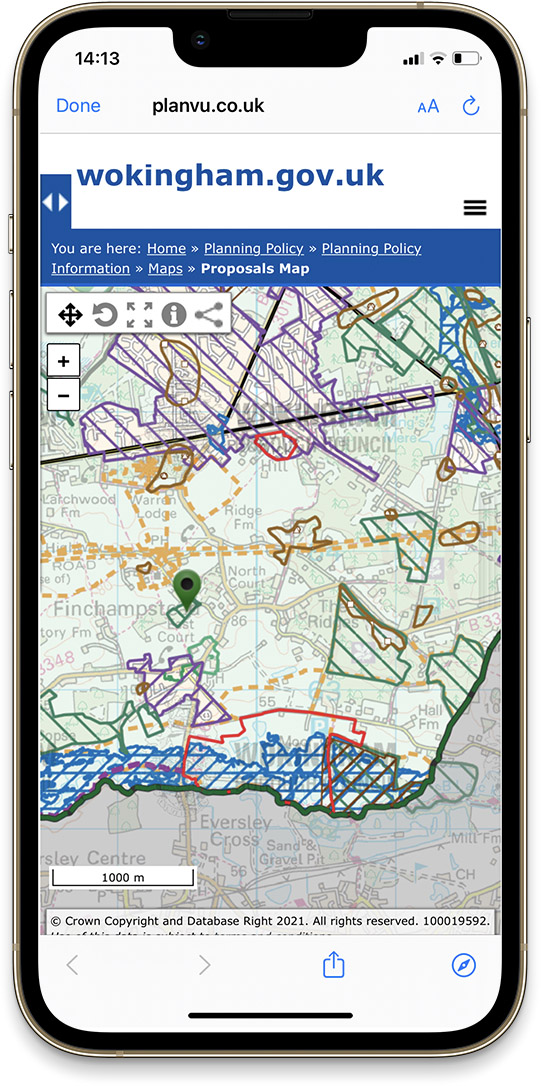
Such an online interactive digital Policies Map can provide familiar large scale Ordnance Survey base mapping, searchable by address, with the ability to link through to supporting text documents explaining the policy detail at that specific search point. Printed maps just can’t compete with that level of interactivity!
We’re very excited to roll out all of these changes, and we’re looking forward to continuing to support Local Authorities Local Plan Policies mapping and solutions in the future.
Comments are closed here.