
What is the length of Britain’s coastline?
So you need to find the length of Britain’s coastline. You could just Google it and get your answer, right?
So you need to find the length of Britain’s coastline. You could just Google it and get your answer, right?

The web-based GIS portal is to map marine and maritime data, renewed for a further two years
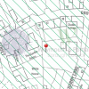
What are the benefits of online, interactive Proposals Maps for Local Authorities?
The Proposals Map (or Policies Map) is a ...
The Environment Agency recently made freely available LIDAR data for over 70% of England. Airborne LIDAR (light detection and ranging) ...
gi Perspective provides organisations of all shapes and sizes with geographic information and digital mapping solutions, utilising our staff's breadth of experience to exceed customer expectations.