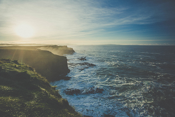
So you need to find the length of Britain’s coastline. You could just Google it and get your answer, right?
Well, you may find it very difficult to get any answers that agree. As leading map makers and experts in GIS services, we are often asked this question, but we know there is no exact answer. So why is the length of Britain’s coastline so hard to calculate?
The Problem
Imagine measuring the coast with a giant 50km measuring stick. You may get a total figure of around 3,500 km for your very rough outline of Britain, but you’ve probably had to skip many of the peninsulas and bays during your measurement. Now use a shorter 1km stick and your overall figure will be longer, but you’ve still not taken into account many coves and small headlands. Using a 10 meter stick your overall measurement will be longer again, maybe nearer 15,000km. This maybe a more realistic figure, but is it correct?
In fact the smaller your stick is, the longer the coastline gets until your measurement is almost infinite. Imagine using your trusty 30cm ruler to measure the coast – think of all those individual rocks and crags you have to go around!
This phenomenon is known as the coastline paradox and has its basis in mathematics. A coastline is in fact an example of a fractal. In this case, the coastline measurement increases exponentially when you downsize the length of your stick. At the same time, the land area is increasingly unchanged.

With the coastline paradox, it quickly becomes apparent why it’s difficult to even give an approximate answer.
There are other factors to consider too:
- whether you are measuring the high-tide or low-tide mark
- how far up an estuary or inlet to measure before crossing it
- which islands you include (and up to what size)
- effects of recent coastal erosion
The Solution
Of course, we don’t have to use a stick. We can use Geographical Information Systems (GIS) to help us. We can download an up-to-date coastline dataset from the Ordnance Survey, specify the minimum length of a line segment (our stick) and in seconds calculate the length of the coast.
A bit quicker maybe, but unfortunately the same problems apply.
Even if we want to compare the length of coastlines between countries we can still have issues – a country’s ‘jaggedness’ of coast may not be apparent if we measure it too coarsely.
So if you need to find out what the length of Britain’s coastline is, you also need to reference why you need to know in the first place. Are you planning to sail around it? Walk it? Or are you interested in comparing the distance against somewhere else for a scientific study? These factors will have a bearing on how you decide to measure the length of Britain’s coast, or whose calculation you trust most. However you do it, be warned – there is no definitive answer.
Comments are closed here.