Housing associations face many challenges in managing their properties, tenants, and operations. Geographic Information Systems (GIS) and interactive maps are powerful tools that can improve efficiency across departments. Here’s how GIS can enhance operations for key departments in housing associations.
1. Housing Management
Housing Management teams can use GIS to manage contracts for services like grounds maintenance and utility providers. Interactive maps help visualise housing layouts, ensuring contractors understand their responsibilities for areas like green spaces and parking. GIS also assists in overseeing energy contracts by identifying properties suitable for upgrades or renewable installations. This improves communication with external contractors, ensures service quality, and helps housing managers maintain efficient, well-kept environments while optimising costs and resource use.
Brent Council use GIS to manage Grounds Maintenance contracts
 Luiri Art/stock.adobe.com
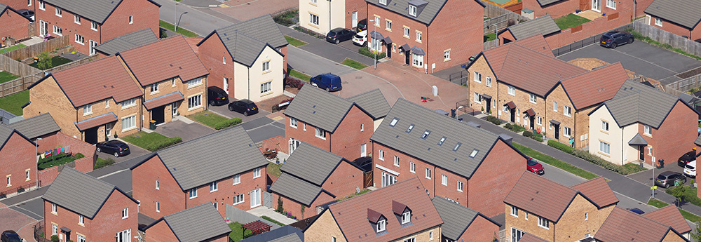
2. Customer Services
For Customer Services, GIS provides a visual platform to access up-to-date information on properties, tenants, and nearby amenities. This allows the team to answer tenant queries more effectively, offering detailed information on services, maintenance schedules, or neighbourhood developments. By identifying areas with high service requests, customer services can proactively address recurring issues, improving overall tenant satisfaction and service quality.
3. Assets
In the Assets department, GIS helps manage and track property portfolios with precision. By visualising data like ownership, building condition, and energy efficiency ratings, asset managers can prioritise maintenance, renovations, and resource allocation. GIS also enables the team to forecast long-term asset needs, reducing costs through proactive planning and improving the longevity of buildings.
Lincolnshire Housing Partnership utilises a GIS-based interactive map to manage their property stock
 onephoto/stock.adobe.com
4. Finance
GIS assists the Finance department in analysing costs and managing budgets. By mapping maintenance expenses, energy consumption, and property values, finance teams can make more informed budget decisions. GIS can also be used to assess investment opportunities and understand how geographic factors, such as flood risks or property trends, could impact the financial performance of housing stock. This improves budgeting accuracy and long-term financial planning.
5. Repairs
For the Repairs department, GIS helps in planning and optimising repair schedules. Teams can visualise where issues are occurring and allocate resources more efficiently. Interactive maps enable technicians to identify nearby jobs, reducing travel time and ensuring quicker responses. GIS can even highlight areas prone to recurring issues, allowing the team to take preventative measures and reduce future repair costs.
6. Contractors
For Contractors, including those working on energy projects or grounds maintenance, GIS streamlines project management. Contractors can easily view estate plans, track ongoing work, and ensure regulatory compliance. For energy installations, GIS evaluates solar potential by analysing roof orientation and sunlight exposure, helping contractors identify optimal properties for solar projects. This improves both efficiency and service quality. In grounds maintenance, GIS provides clear visuals of contractor responsibilities, ensuring they know which areas to maintain, preventing disputes with tenants.
 heather/stock.adobe.com
7. Compliance
In the Compliance department, GIS ensures housing associations adhere to regulatory requirements. Compliance teams can monitor properties against environmental risks, such as flood zones, and ensure adherence to local building codes. GIS also helps track and document inspections and upgrades, providing a clear record of compliance efforts. This makes it easier to manage audits and reduces the risk of non-compliance.
8. Income
The Income department can use GIS to track rent collection patterns and visualise areas where tenants may be struggling with affordability, such as neighbourhoods with high fuel poverty. By mapping income levels and rent arrears, the team can create targeted support plans, such as financial assistance or energy-saving upgrades, to help tenants. This approach reduces arrears and strengthens financial stability.
 Tom Falcon Harding/stock.adobe.com
9. Risk & Insurance
For the Risk & Insurance department, GIS provides detailed insights into potential risks across the housing portfolio. Interactive maps can identify properties in flood-prone areas, high-crime zones, or those vulnerable to weather damage. This allows the team to adjust insurance coverage, take preventive measures, and minimise liabilities.
GIS and interactive maps offer housing associations a powerful way to improve decision-making and enhance operational efficiency across all departments. From managing assets and repairs to boosting compliance and reducing financial risks, GIS helps housing associations operate smarter and deliver better services to tenants. By embracing these technologies, associations can ensure more sustainable, proactive management of their housing stock and resources.
Comments are closed here.