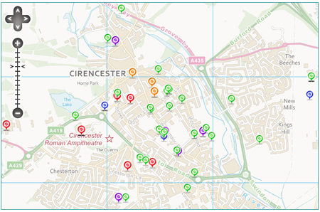
A new “demo” map released by the Department for Local Government and Communities locates more than 180,000 assets owned by almost 600 public sector bodies, including Central Government and 87 councils.
The purpose of the interactive map is to show the public exactly what places in any area are owned by the state and its departments.
The Government hopes that putting this information in the public domain will encourage residents and councils to see if any could be better utilised or sold off to keep council taxes down.
Secretary of State for Local Government and Communities, Eric Pickles, has said: “We need to know, now more than ever; exactly what assets are publicly owned. The general public probably have no idea of the sheer scale and scope of property and land on the public sector’s books. In many cases it goes way beyond traditional frontline services.
“I want the public sector to take a good hard look at what they own. By cataloguing each and every asset councils can help Government find innovative new ways to utilise them, improve local services, keep council running costs down and save taxpayers’ money.
“This asset information also holds huge potential for local communities, offering an at a glance way to find that new meeting place or rescue the derelict tennis court round the corner.”
To see the assets visit http://publicassets.communities.gov.uk/

Comments are closed here.