In September of this year, the newest release of the European Atlas of the Seas has created a game changer of sorts for anyone seeking oceanic information in Europe. Visitors to the online resource can now navigate the Atlas in the 24 official languages of the European Union. This extensive translated work is sure to increase access to stunning marine maps, and a thirst for popular marine topics such as tourism, litter, environment, energy and aquaculture amongst several others.
What is the European Atlas of the Seas?
The European Atlas of the Seas is an online interactive and educational web mapping application, dedicated to exploration and greater understanding of Europe’s seas and coasts. It is the official digital mapping tool of the European Commission’s Directorate-General for Maritime Affairs and Fisheries and is an effort to increase oceanic literacy.
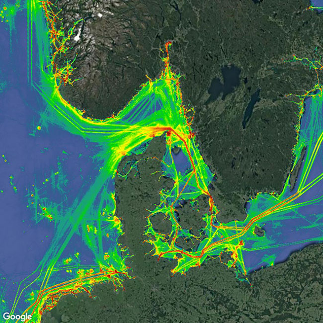
There are several map providers that have contributed to the Atlas of the Seas including EMODnet (the European Marine Observation and Data Network) that has provided 135 maps on its own. As GIS consultants and spatial analysis experts, gi Perspective has contributed to EMODnet Human Activities for several years. Most recently we aided the creation and implementation of vessel density mapping into the Human Activities web GIS tool across European seas.
Amongst some of the newer features in the Atlas of the Seas, is an improved print module and measurement tool, short stories with interesting map layers, and an interactive help menu to guide visitors to the Atlas to where they want to go.
Making a tool such as this multi-lingual is certainly a landmark achievement, in the efforts to educate and inform anyone interested in oceanic life and displaying it as a valuable resource.
Comments are closed here.