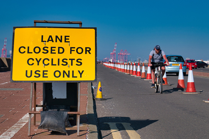
The Coronavirus pandemic is changing the way we exercise and commute. There has been a noticeable boom in cycling, both in urban and rural areas. In early May, a £250m emergency fund was made immediately available to improve infrastructure and encourage cycling, in order to ease the pressure on public transport (and maintain social distancing) as lockdown restrictions are eased.
Many Councils are now looking at schemes to improve cycling hot spots and protect cyclists. This could include:
- Creation of temporary protected cycleways
- Installation of street furniture (plant containers, bollards etc) to prevent motor traffic
- Widening of existing cycle paths to allow for safe two-directional cycling
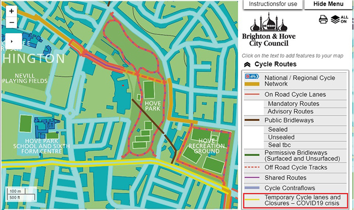
Keeping cyclists up-to-date with such changes is a challenge. Interactive cycle maps are becoming increasingly popular with Councils and transport groups to encourage cycling and to communicate the location of cycle lanes and recommended routes.
It’s not purely about location either. They can also be used to find out the form of a particular cycle path. For instance:
- Is it a dedicated path or shared with pedestrians?
- Is it on-road or off-road?
- Is it well lit?
- How does it link to the larger transport network?
The location of toucan crossings, cycle parking, bike carrying bus stops and repair shops is also useful information for any cyclist.
Brighton and Hove City Council made changes to their interactive cycle map on the 19th May 2020, days after the UK Government eased some lockdown restrictions in England. This includes the location of temporary cycle lanes and road closures directly attributed to the Covid 19 crisis.
Many cyclists and environmental activists are seeing the emergency funding as the start of a once-in-a-lifetime opportunity to encourage cycling, address urban pollution and link cycling more seamlessly with public transport.
Comments are closed here.