GIS Spatial Analysis for vessel density mapping across Europe
Requirement
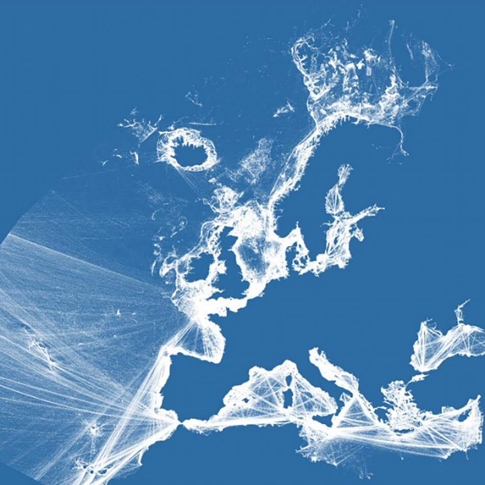
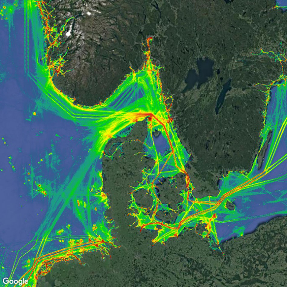
As part of our work towards the European Marine Observation and Data Network (EMODnet), we were asked to write a number of scripts to convert ship location data from the Automatic Identification System (AIS) to a set of map visualisations showing shipping density over time and by shipping category. The extent would cover all of Europe, which had not been done before on such a scale.
Solution
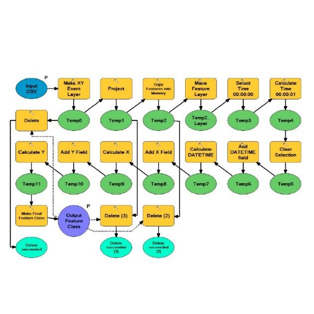
Before embarking on the coding, we consulted with our consortium partners to define shipping density. The coding was then designed and developed to be as efficient as possible, to enable the monthly processing of millions of individual AIS signals. If you’d like to know a little more about AIS and how it works, we have published a blog on the subject. The solution was to develop scripts in a combination of environments including ArcGIS Desktop and PostgreSQL.
Result
The scripts are used on a monthly basis to create freely accessible visualisations which instantly give a clear picture on shipping activity throughout Europe by month and shipping category. This can be used by both the public and private sectors to aid the analysis of vessel activity, such as the environmental effects of cargo shipping and how monthly fishing activity is effected by area specific bans. We also contributed to the white paper (PDF) describing the full end-to end method.
Further reading
Read our gi Perspective blog – How to turn ship location signals into a vessel density map