Requirement
We were asked by Forestry Enterprise Scotland, the Agency that manages the Forestry Commission estate in Scotland, to help accelerate a programme of Soils data capture and associated attribution processes.
Solution
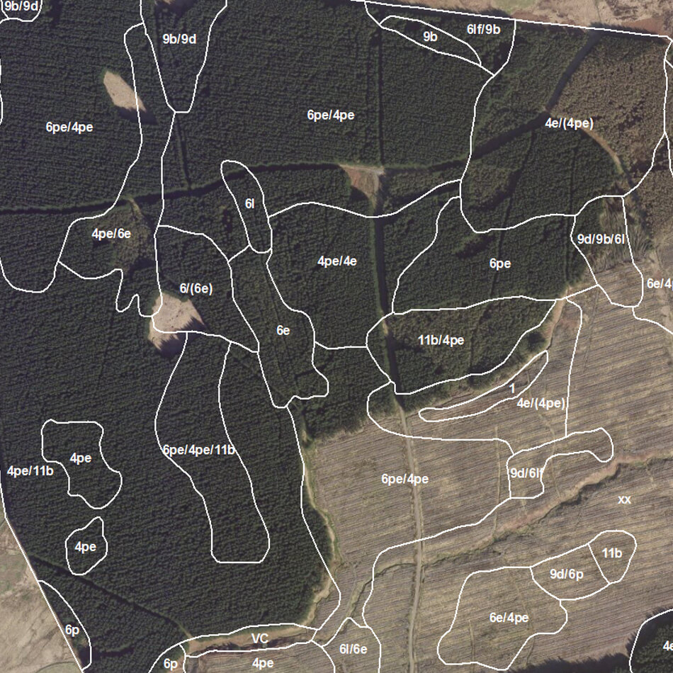
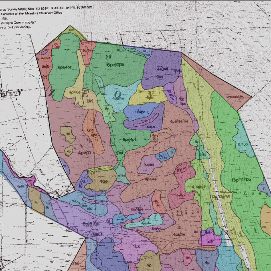
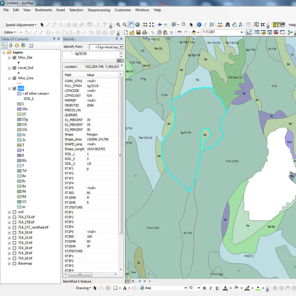
Phase 1 of the project was the digitising and attribution of approx 14,000 hectares of soils from soil survey scans into a GIS. The captured GIS data was held in ESRI Personal Geodatabases with attribution entered via the provided Forestry Commission Soils Data Capture Tool. Phase 2 of the project involved the additional requirement of referencing conversion tables at the soil type attribution stage and required this process for 40,000 hectares.
Technical Quality Control checks were made to ensure the topological consistency of the captured data, and completeness and consistency of the attributes.
Result
Christine Brown, Spatial Data Project for FES commented “thank you and your team for an excellent service and contribution to our soils project. Your patience and co-operation have been greatly appreciated and I hope there will be occasions to work together in the future.”