Requirement
Through the release of the EU Green Paper on a Future Maritime Policy for the European Union in 2006, poor access to marine and maritime data was confirmed to be a barrier to scientific understanding, a brake on the economy and a handicap to government decision-making. In 2008 the European Commission proposed to take steps towards a European Marine Observation and Data Network (EMODnet).
Our parent company, Lovell Johns are part of a consortium of companies (with partners from Italy, France, Spain and Denmark) awarded a three-year contract in September 2013 by the Directorate-General for Maritime Affairs and Fisheries (DG MARE). The contract has twice been renewed, most recently until March 2023, with extensions available to March 2025. The aim of the current contract is to continue to assemble fragmented marine and maritime mapping data on the extent and intensity of human activities, and to further develop the web mapping portal and related web services.
Solution
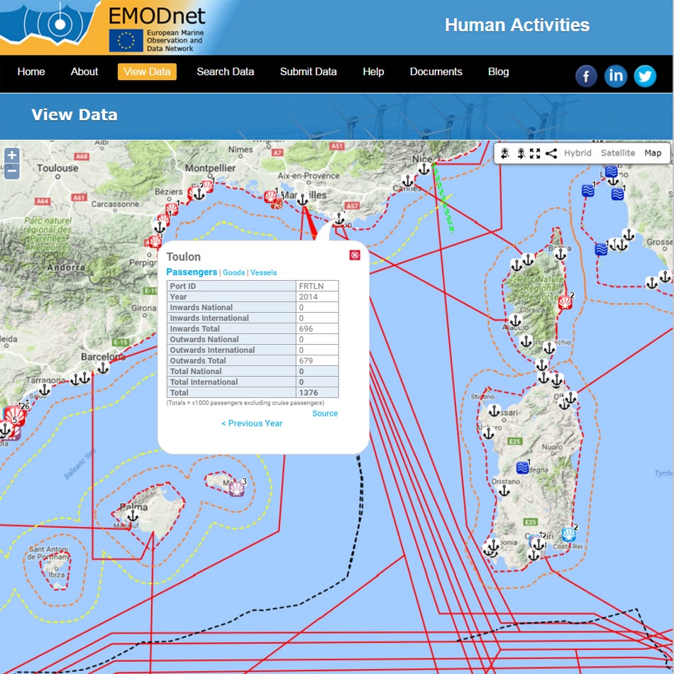
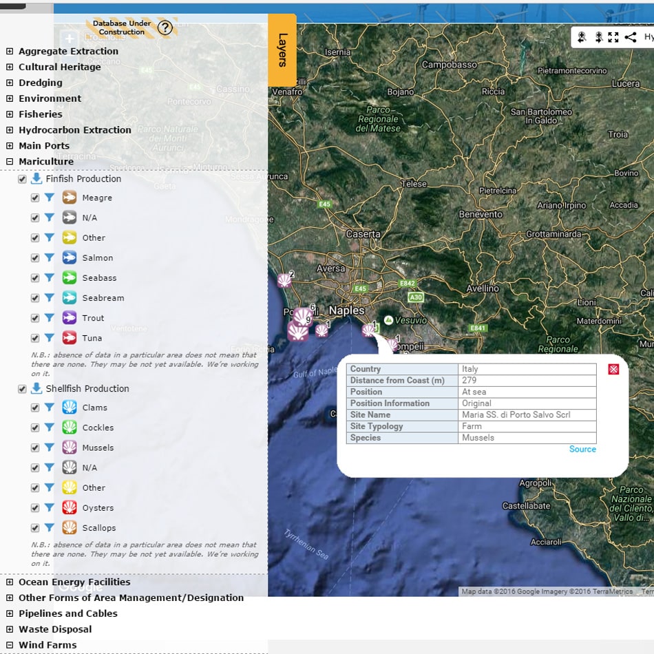
The EMODnet Human activities web mapping portal, under our development, presents marine and maritime mapping data on a series of activities related to the sea. The mapping data is collated and harmonised by the other consortium marine and maritime specialists. GIS layers such as aggregate extraction, dredging, commercial shipping, pipelines and wind farms can be viewed and interrogated using the web portal. The tables hold approximately 36,000 Points, 1,500 Lines and 12,500 Polygons.
Result
The initial website has been further developed in Phase 2 as more data has been added. Access is designed both for non-GIS users and spatial data specialists. Web services have been implemented so GIS data can be served directly from the website to desktop software and other web applications. The web portal makes use of responsive design, allowing the information pages to resize and adapt the layout according to the screen space available on the viewing device. Many public and commercial organisations are using the GIS web services to aid better decision making.