Natural resource management (NRM) is increasingly relying on cutting-edge technologies to address challenges like deforestation, climate change, water scarcity, and biodiversity loss. At the heart of this digital transformation is Geographic Information Systems (GIS). Whether it’s through real-time monitoring or predictive modelling, GIS offers game-changing solutions. Here are five impactful ways GIS supports sustainable NRM.
Habitat & Biodiversity Monitoring
GIS is essential for habitat and biodiversity monitoring, offering powerful tools to map species distributions, track habitat changes, and identify ecologically sensitive areas. In the UK, it plays a critical role in supporting Biodiversity Net Gain (BNG) – a policy requiring developments to leave biodiversity in a better state than before.
By using spatial data to assess baseline ecological conditions and model projected habitat outcomes, GIS enables planners and ecologists to ensure compliance with BNG requirements. It also aids in long-term monitoring, helping to safeguard priority habitats and inform targeted conservation strategies across landscapes.
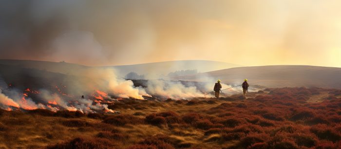
Analysing Wildfire Risk
 vxnaghiyev/stock.adobe.com
GIS is a powerful tool for analysing and mapping wildfire risk, enabling land managers and emergency services to make informed decisions about prevention and response. By integrating datasets such as historical wildfire locations, vegetation types, topography, and infrastructure, GIS can help identify areas most vulnerable to ignition, spread, and impact.
Risk modelling at a detailed spatial scale supports targeted interventions and resource allocation. Even without advanced fire simulation tools, GIS-based approaches offer a practical, evidence-led method to assess and visualise risk.
Resource Mapping & Inventory
GIS is fundamental to natural resource mapping and inventory, providing detailed spatial data on assets like forests, water bodies, mineral deposits, and biodiversity. By compiling and visualising this information, organisations can make more informed decisions about land use, conservation, and sustainable development.
GIS enables the creation of dynamic, layered maps that reveal patterns, track changes over time, and support accurate resource valuation. This approach is crucial for managing natural resources efficiently, especially in areas facing development pressure or environmental risk.
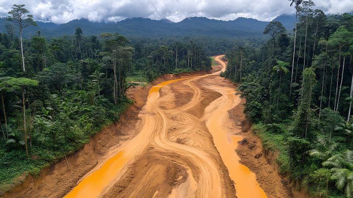
Illegal Activity Detection
 ayo/stock.adobe.com
GIS is increasingly being used to detect and monitor illegal activities such as logging, mining, and poaching, particularly in remote and ecologically sensitive regions. By analysing satellite imagery and mapping features like unregistered roads or changes in forest cover, GIS helps identify signs of unauthorised access and environmental degradation. These insights support enforcement efforts and conservation planning. For example, GIS tools have been used to map forest roads linked to logging activity, with data made publicly available to encourage citizen science and global monitoring efforts.
Community Engagement
GIS plays a valuable role in promoting community engagement by making environmental data accessible, interactive, and locally relevant. Through user-friendly digital maps, residents can explore green spaces, learn about local habitats, and actively contribute to environmental stewardship.
Tools like ArcGIS Online and mobile survey apps enable communities to report issues, record wildlife sightings, and even help monitor urban nature features. These platforms not only build awareness but also foster a sense of ownership over local green infrastructure.
Comments are closed here.