As experts in cartographic production, we’ve continuously provided printed proposals maps to local authorities for well over 25 years. Printed maps aside, we are also well-equipped in dealing with mapping requirements in a digital or interactive space as well.
Planvu is Lovell Johns’ very own Local Plan digital mapping software, that facilitates increased user engagement by providing the public, developers and staff with free, intuitive mapping information on a council’s Policies Map.
We’re constantly looking to improve upon Planvu and part of that involves examining how our clients interact with it. When we looked at the Google Analytics reports for the first six months of 2019 for 3 of the interactive mapping sites we provide for Local Authorities in Burnley, Weymouth and West Dorset, we spotted an interesting trend. We found that all visitors spent an average of nearly 2 minutes on a site.

So that got us thinking about how efficient Planvu might be in accomplishing tasks that might take just 2 minutes. Let’s have a look at what we managed to do in that time!
Postcode-based Policy searching
In this test, we wanted to see if a typical user could search for a postcode location then read up about a specific Planning Policy. We entered a postcode DT1 1UZ, used the Policy identify tool to find policies at the specific point and found a number of planning policies returned in the Policies tab.
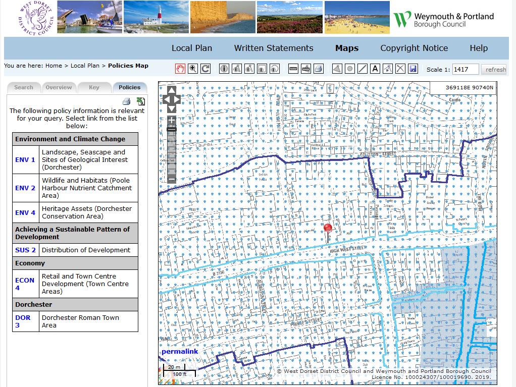
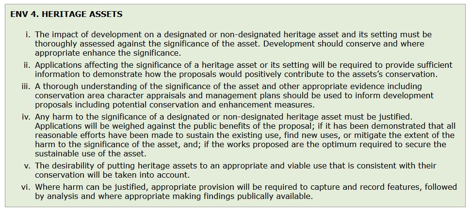
We wanted to read about Environmental and Climate Change policy ENV 4 Heritage Assets and were able to click through to this policy text in under 1 minute. Mission accomplished!
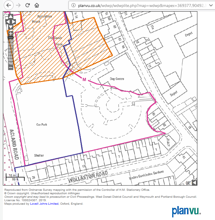
Searching and measuring an area
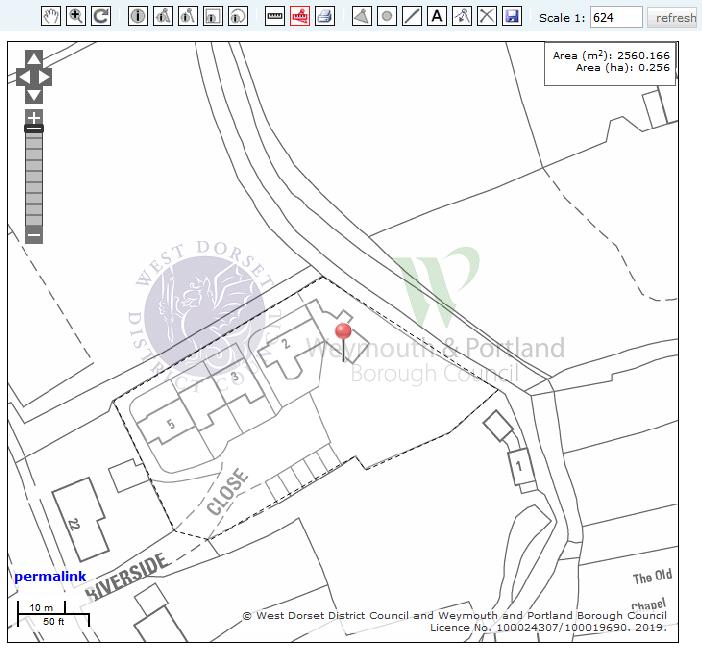
For this test we searched on a specific location of Cerne Abbas in Dorset using the Quick Links list place names, then zoomed into Ordnance Survey MasterMap (at a scale of 1:624). From here, we switched off all of the Plan layers and measured an area by using the drawing tools to draw around the perimeter of a field boundary. The result below took around 1 minute 10 seconds.
Drawing and labelling an area and saving it off
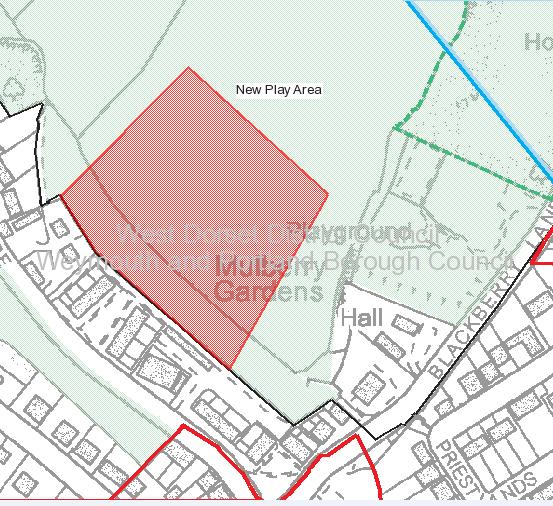
With this online mapping test, we selected the town of Sherborne in Dorset, then zoomed and panned the mapping to bring a greenspace area into view, where we could draw and label a new feature. We then saved this custom map as a JPEG file, creating a proposed new play area as shown below. This took 1 minute 28 seconds.
Printing out and annotating a map
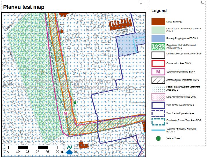
In this test we searched on a DT postcode then panned and zoomed the map. We then activated all Map Layers as above, then print-previewed the map using the Planvu print wizard. We also spent time giving the map the title ‘Planvu test map’. All done in just a minute and 45 seconds!
Creating and sharing a unique map of Local Plan layers
In this final test, we selected a specific address from the Planvu gazetteer, then spent a little time navigating and deselecting some of the Plan layers. This specific map content can then be shared by using the permalink tool which we did by copying and pasting a new unique URL into a web browser. All of this activity took approximately 1 minute 23 seconds.
As demonstrated above, it’s clear that Planvu can come in handy with many useful tasks around searching and retrieval of Local Plan information. And of course, we acknowledge that some users might work a little slower than this. However, given the level of detail and user-intuitive control Planvu gives a user, this should not pose a great challenge. We would also do well not to underestimate the skill levels of our users either.
With the increase in the provision of digital content and services by councils in recent years, citizens are more encouraged and confident to engage online through web forms, tools and apps. Interactive mapping and in particular the online Local Plan Policies Map is one such example of how users can easily access detailed information through a web browser.
Online Proposals Maps have the advantage of providing very large scale searchable mapping for the whole of a borough and linking this to appropriate planning policies, something that is not possible with a traditional paper proposals map. Planvu can be an invaluable tool to meet this requirement.
We would invite you to explore it for yourself and let us know what you think about it.
Comments are closed here.