Requirement
Mobile Fleet Services provide cost effective vehicle servicing and maintenance to businesses who want to minimise the vehicle/driver downtime, disruption and costs of vehicle servicing. The use of a mobile service reduces additional costs such as replacement vehicles, the inconvenience of having to transfer specialist equipment from one vehicle to another and the need to transport vehicles to and from a static supplier.
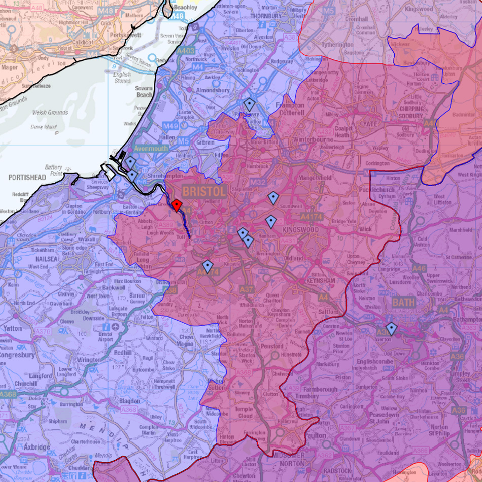
The business had identified a need for mapping software to provide management with visualisation and reallocation of unique territories. Defining each Technicians territories by postcode districts, Mobile Fleet Services wanted to visualise these areas over multi-scale UK base mapping, have the ability to reallocate postcodes and amend territories and also edit Technician details. A Management Module was required to control user access and map sharing privileges.
Solution – Open Data and Open GIS Database Creation
After consultation and demonstration of relevant reference sites, we proposed a web mapping approach over a desktop solution for reasons of ease of access, security and updating; specifically the Ordnance Survey OpenData digital mapping was chosen as base mapping and brought into an Open Source GIS environment.
The Technician territories were created from their respective postcode districts and shown as coloured transparent polygons or areas. Specific functionality was scoped and agreed with the client in advance and beta version provided comments and amendments. The Management Module is accessed from a separate URL with different username and password. Lovell Johns host the solution and continue to provide support for future development.
Result
The mapping software has provided Mobile Fleet Services with a user friendly digital mapping solution which enables them to accurately and efficiently define Technicians territories and also gives a great interactive view of all the areas covered.