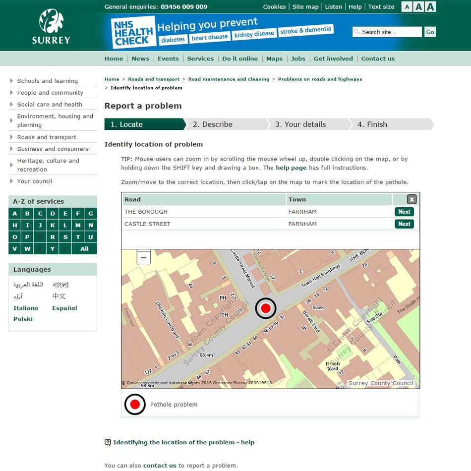
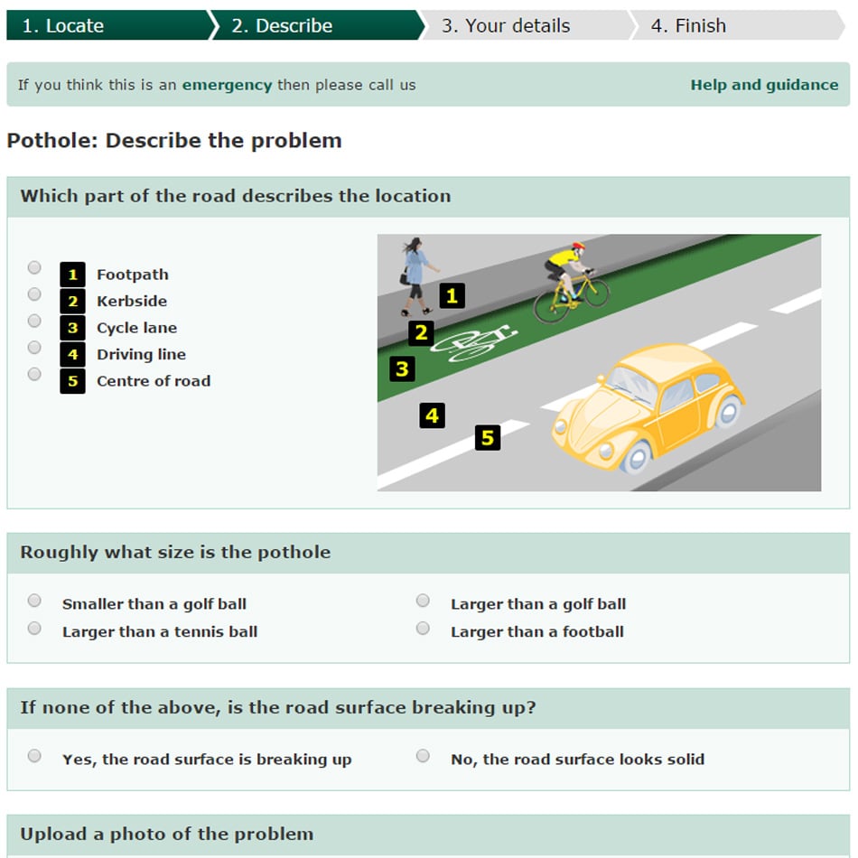
Requirement
Surrey County Council approached gi Perspective with a requirement for GIS work to be completed as part of an emerging Highways Contract. The Highways Department were seeking to develop a map-based road surface defect reporting and tracking system, aiming to empower the public with a means of reporting and tracking defects online, also to provide better information for Contractors to locate and understand the priority defects.
Solution
gi Perspective were contracted to develop a map based viewer in which the user could report an accurate location for a road surface defect. The application was based on Esri ArcGIS for Server technology with JavaScript API, and interacted with Ordnance Survey road centreline data, the Council’s gazetteer web services and online reporting system. Large-scale base mapping was cartographically styled and cached for quick display.
Result
gi Perspective consulted closely with Surrey throughout the development path. As part of the Esri Developer Network (EDN), gi Perspective developed and tested the application in a mirrored environment before handing over the solution for hosting by Surrey. Further ad-hoc developments were made so the map services could be utilized by other applications, such as where’s my nearest?.