Requirement
gi Perspective were approached by The Roman Catholic Diocese of Hexham and Newcastle with a request to produce a new modern and accurate digital mapping dataset of their Parish boundaries with only textual descriptions of historical geographic features as input. The new mapping, to be informed through a consultative process involving parishes, schools and the Council of Priests, was needed to assist the Diocesan schools with the implementation of the admissions guidance.
Solution
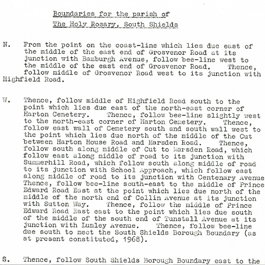
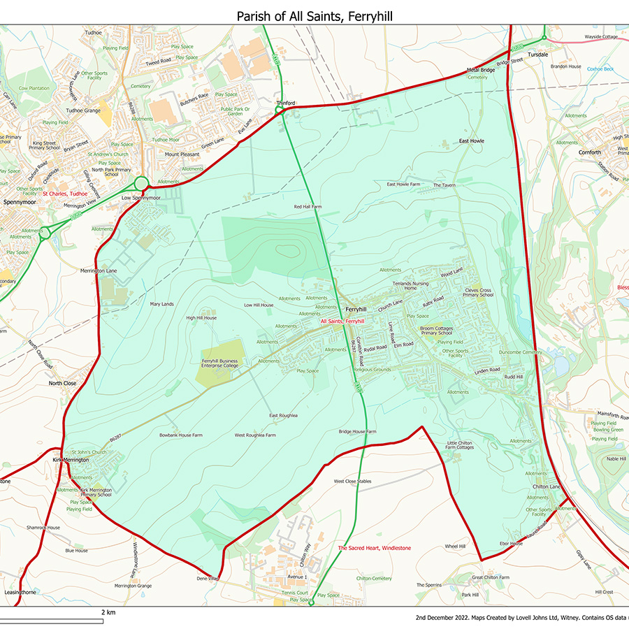
The historical textual geographic description of each parish was interpreted into a spatially referenced boundary using modern reference royalty-free base mapping from the Ordnance Survey (OS). An initial map of each parish was produced for The Diocese’s review and comment then any requested boundary amendments were made to produce a master set of parish boundaries and a subsequent final set of PDF maps.
Result
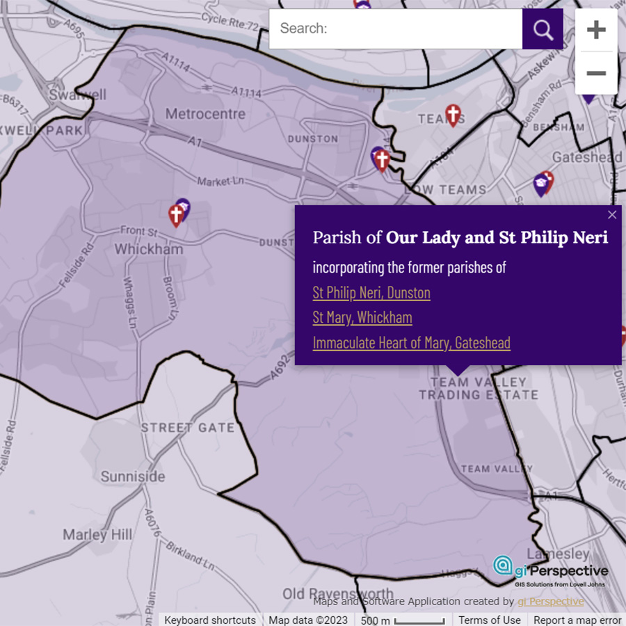
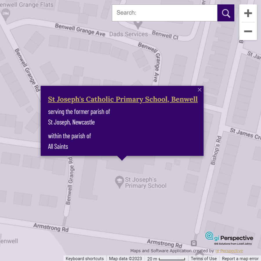
Once fully approved, a total of 134 current parish maps were printed at A1 size. These were subsequently used within Parish Decrees which were signed by the Bishop and distributed to each parish. A total of 176 current and former parish boundaries were then consolidated into an interactive online map which also features all schools and churches of the Diocese. A custom Google base map was chosen as the backdrop to provide user familiarity and ease of navigation. The schools and churches layers have links to further information.