Requirement
A respected NHS Foundation Trust was interested in the increasing distances their patients seemed to be travelling from. The Senior Communications Manager wanted to confirm that the trend was real and use maps to demonstrate the growing reach of the hospital.
Solution
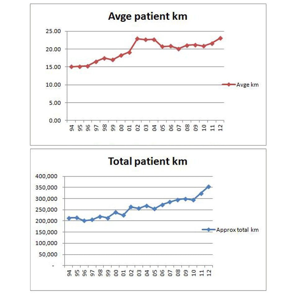
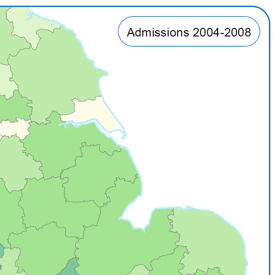
We were supplied with anonymised spreadsheet data giving postcodes of admitted patients over a number of years. Admission-distance trends were analysed across the time period and reported back to the Trust as maps, charts, and a table. Sample data was georeferenced to demonstrate alternative ways of mapping patient locations, such as dot maps or heat maps.
Result
After a consultation, a sequence of maps was commissioned for use on the Trust website, showing the increasingly regional and national reach of the hospital over a 20 year period.