Housing associations are increasingly turning to GIS mapping software and digital map data to increase operational efficiency and visualise their assets. By converting legacy paper map records and accompanying Excel listings into a GIS solution, the spatially referenced datasets become much more useful for management decision-making. GIS solutions can be deployed via desktop or web-based interfaces. They are highly scalable as further data is added and new users come on board. This article considers some of the ways in which housing associations are benefitting from GIS solutions.
The Grounds Maintenance management information used by housing associations can still exist in the form of paper map plots that have been heavily annotated over time to reflect changes in types of open space. Just two examples of where GIS software can increase efficiencies are: the calculation of tenant green space GM charge out rates; and negotiation with contractors for grass cutting services. Holding the GM data in a GIS allows common types of grass cutting area or fence perimeter lengths to be quickly summed. These figures can be easily shared with tenants to illustrate charge rates or with contractors to define and agree on maintenance contracts.
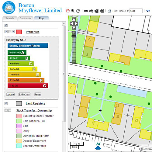
The assets of a housing association will always have a spatial reference such as a full address or postcode. The housing association will also hold other property-specific data such as ownership status, year of build or number of bedrooms. Bringing such attribute data into a GIS system allows staff to visualise the assets in terms of these important characteristics and increase efficiency. An example would be for the map to show properties with different colours depending on their ownership status. It also allows filtering of the data by those attributes. For example, mapping software can allow you to see which Right To Buy properties fall within a Conservation Area or flood zone. Such GIS use provides quicker, more accurate management information and analysis which is simply not possible by comparing tabular data.
The front-line services of housing associations are dealing with customer queries more efficiently by using GIS mapping software. By having access to the latest digital mapping layers of property-specific information such as Land Registry titles and ownership status in a single map-based environment, issues are easily visualised and shared between departments, and the first-line response to customer queries is dealt with more quickly.
Housing associations can also increase efficiency through GIS software in development planning. Faced with site selection decisions on new housing development and re-development, digital mapping provides a powerful tool for showing different aspects of a development site. Map layers such as planning applications, Local Plan designations and rights of way can be viewed over architects” plans of development sites, providing accurate and timely management information.

Comments are closed here.