This is our list of top GIS free resources and resource sites maintained by our GIS consultant and manager.
World Digital Elevation Models and Bathymetry
General Bathymetric Chart of the Oceans (GEBCO)
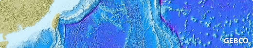
The General Bathymetric Chart of the Oceans (GEBCO) aims to provide the most authoritative, publicly-available bathymetry data sets for the world’s oceans.
The GEBCO One Minute Grid offers a a global, one-arc minute bathymentry dataset. A global 30 arc-second grid is in development stage. Both grids are freely available and downloadable along with the custom software required to extract the grids to a useable format.
For details about the grids and on how to download them, visit:
ETOPO1
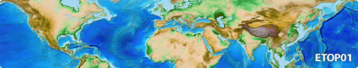
ETOPO1 is a freely available DEM that includes both bathymetry and topography. It has a resolution of 1 minute (approximately 2km) and covers the whole world. The resolution is suitable for world mapping.
For more details on the public data distribution rights and how to download ETOPO1 visit:
National Geophysical Data Centre (NGDC)
GTOPO30
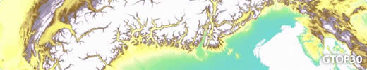
GTOPO30 is a freely available DEM. It has a resolution of 30 arc seconds (approximately 1km) and covers the whole world. The resolution is suitable for continental or country mapping. For more details on the public data distribution rights and how to download GTOPO30 visit:
SRTM
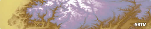
The Shuttle Radar Topography Mission (SRTM) is an international research effort that obtained a DEM on a near-global scale from 56 degrees S to 60 degrees N. It has a resolution of 1 arc second (approximately 90 meters), and is suitable for regional mapping. For most of the World, SRTM is the most detailed DEM available. Pre-created hill-shading based on the DEM is also available.
For more details on the public data distribution rights and how to download SRTM data visit:
World Vector and Gazetteer Data
GeoNames
GeoNames is a database of 8 million geographical names with longitude and latitude coordinates, available under a creative commons attribution license.
The accuracy GeoNames means that it is suitbale for mapping geogrphical places at country or World level. It is editable by the public and therefore not recommended for published mapping.
However, given it’s sheer number of entries and its accessibility through a number of web services, GeoNames offers a good solution for integrating geograpahical names into interactive mapping websites. The BBC, Nike, Greenpeace and LinkedIn already use GeoNames in this way.
For more information and to download data, visit:
Vector Map (VMap)
Vector Map (VMAP), is a vector-based collection of GIS data covering the World at various detail levels.
Level 0 (VMap0) has global coverage, and is entirely in the public domain. VMap0 is at a scale of 1:1 million. It is a slightly more detailed reiteration of the Digital Chart of the World (DCW) which was developed in the 80’s and early 90’s, and is therefore dated. However depending on your purposes, VMap0 may still offer valid geometry for features that do not change significantly (such as coastline and drainage) and offers a good starting point for areas of the World where vector data is hard to come by.
Level 1(VMap1) is at a scale of 1:250k, and about a quarter of the World’s coverage is in the public domain. For more information and to download data, visit:
World Time Zones
ESRI have made available World Time Zones free of charge in an ESRI compatible format. It is available to download via the geography network explorer. For more details and to download go to: