Requirement
The Research Solution is a market research agency which is focussed on the value and impacts of travel & tourism to an area or business. They were commissioned to analyse leisure use within a much-visited National Landscape, and their visitor survey collected maps of the walking & cycling routes taken by visitors. Gi Perspective were brought in to the project to get the most from the wealth of spatial data that was collected. We were asked to capture the routes from the paper survey maps, and then to show this route traffic across the protected area with some clear data visualisations.
Solution
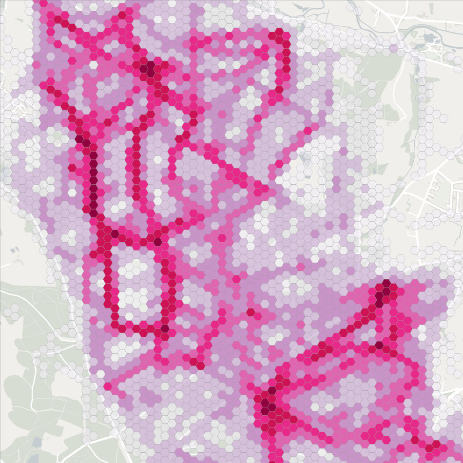
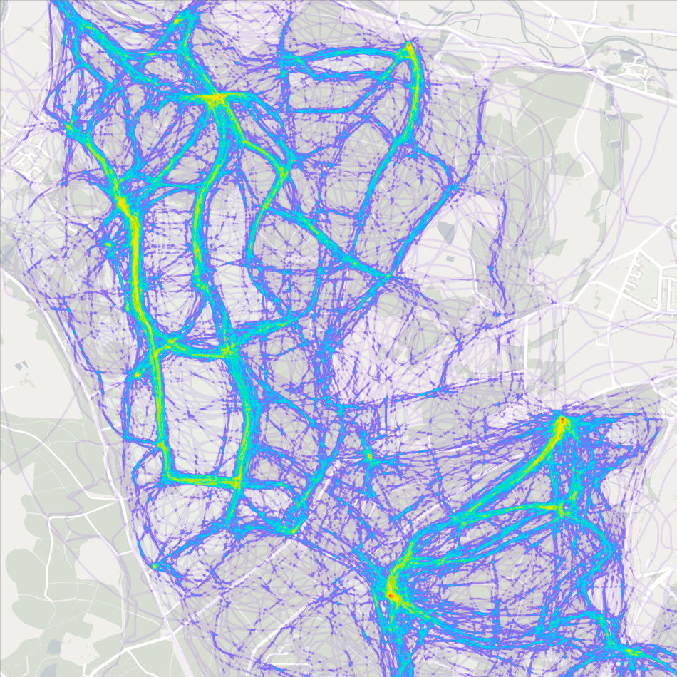
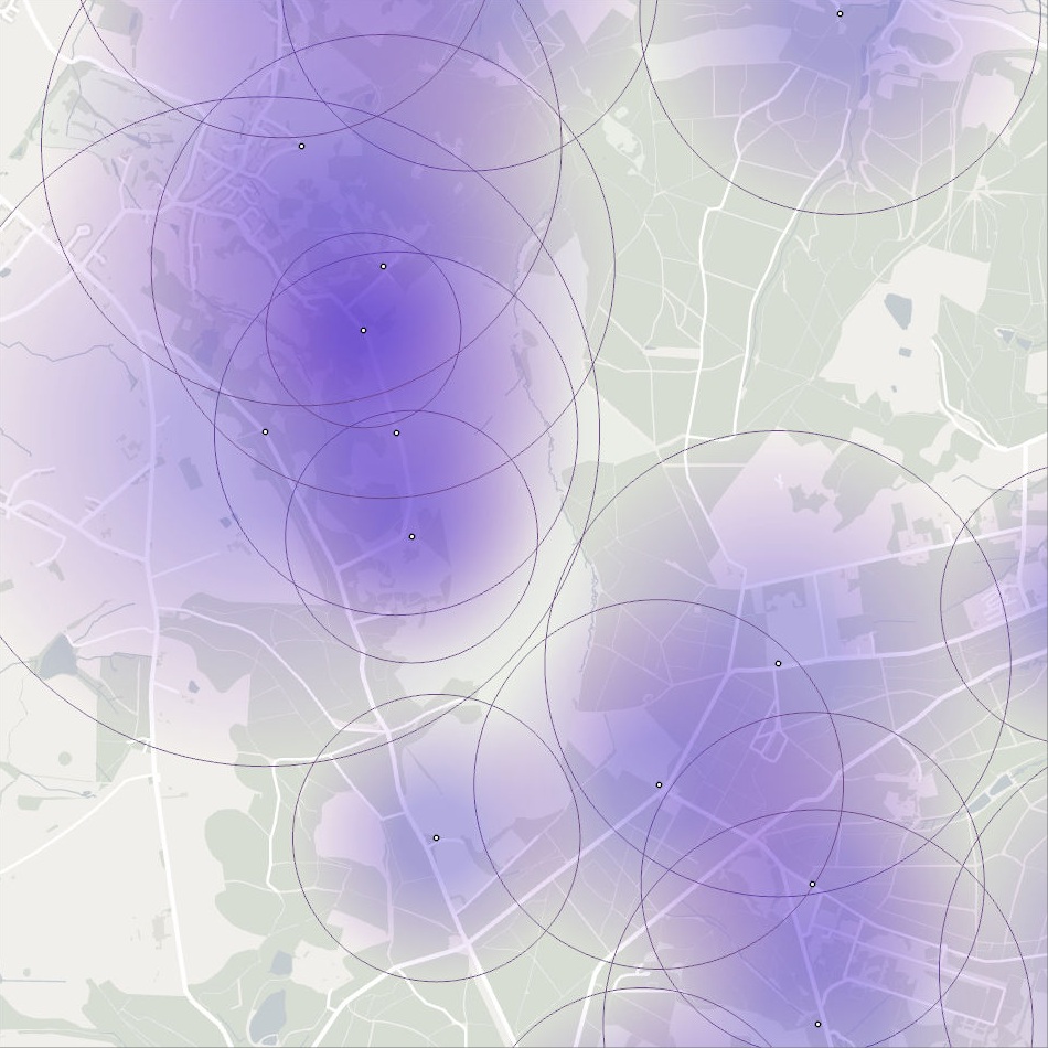
After reviewing the 800 route maps generated by the survey, we agreed a suitable set of capture rules, and managed the digitisation process over just a few weeks. Once the route lines were captured in GIS format, we were able to use the power of GIS software to analyse, report and map. The managing authority were keen to understand how far the different types of visitors were travelling, and if those route length varied in different parts of the recreation area. This intelligence was provided as Excel report tables and several styles of map. Visitor densities were shown by simple line heatmaps and a more sophisticated grid of 1 square kilometre hexagons.
Result
The various GIS outputs significantly enhanced the survey reporting. Survey IDs allowed the spatial information to be linked back to other interview questions, so that the data could be stratified and user groups like dog walkers or cyclists could be assessed separately. Clear, impactful maps provided a snapshot of recreational use within the protected landscape.