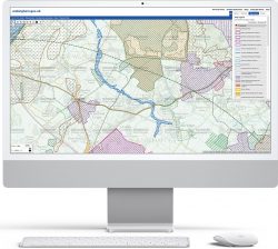
Custom interactive maps, such as those built by gi Perspective, allow the public to interrogate and interact with your GIS mapping data. If your data is located in Great Britain, then the Ordnance Survey (OS) APIs can be used to provide a mapping backdrop and location search functionality.
The APIs (Application Programming Interfaces) provide our developers with a way to communicate directly with OS mapping and search services. Some services are only available as a premium product or to those with a Public Sector Geospatial Agreement (PSGA), however those services based on existing free OS datasets are free to use. Furthermore, a certain quantity of premium transactions are available per month before there is a cost implication.
Here are 5 ways the OS APIs can be utilised with an interactive map build:
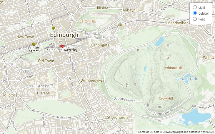
1. Consistent style of mapping
The OS Maps API allows us to provide consistently styled scales of mapping to allow users to pan and zoom the interactive map without the base mapping changing to a different set of colours or fonts. Two default styles are available, suited to either transport or outdoor leisure with a third ‘light’ theme specially designed as a backdrop to sit behind your own colourful map layers so that your data stands out. Furthermore, the OS Vector Tile API allows the development of custom mapping styles.
2. Unrivalled levels of detail
Ordnance Survey mapping is known for its consistency and high-level of detail. The premium OS Maps API and OS Vector Tile API requests make use of their flagship MasterMap Topography layer, which contains over 500 million real world objects such as buildings, paths, fences and field boundaries.
3. Free comprehensive name search
The freely accessible OS Names API allows our developers to create location-based search functionality. The API returns locations for named features such as settlements, roads, postcodes, woodlands and forests.
4. Full Address search
The premium OS Places API can be used to configure address search tools using a full or partial address, a postcode, or a Unique Property Reference Number (UPRN). This includes the ability to return the address of a specified location or to return all addresses within a user-defined area. The UPRN can be linked to your own data related to individual properties.
5. Always up-to-date
Using the OS APIs means there in no need for us to update or download the latest version of the backdrop mapping or location databases. OS always provides the most up-to-date mapping and data for its APIs.
In summary, the look and feel of custom interactive maps as well their search tools can be enhanced and kept current using OS API’s.
Comments are closed here.