Active Travel Map
gi Perspective design, build and host Active Travel Maps for Local Authorities in the form of online interactive mapping websites. Active Travel Maps support council travel strategies in promoting greener modes of transport and healthier lifestyle.
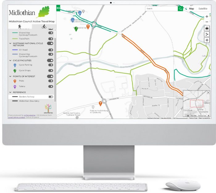
What is an Active Travel Map?
- Mapping software displaying the different types of walking and cycling routes available in a local authority area
- Fast and responsive navigation using customised Google Maps base mapping and satellite imagery
- Easy and quick to set up from client-supplied routes
How is an Active Travel Map useful?
- Supports uptake of greener transport alternatives by providing digital mapping for all
- Mobile and tablet compatible
- Differentiates between route types such as on road; available/planned; easy/moderate
- Share map view between users
- Link to further information
- Displays bike parking, cafes, etc.
How is an Active Travel Map implemented?
- We process the routes and any point datasets
- Design and build the Active Travel Map using Open Source software
- Host and maintain the Active Travel Map
- Support the map and carry out updates through an SLA
![]()
Active Travel Map
Want to know more about Active Travel Map and how we can help you? Why not chat to a member of our team today by calling 01993 880944 or email us at enquiries@giperspective.co.uk
Experts in Geographic Information Systems
gi Perspective provides organisations of all shapes and sizes with geographic information and digital mapping solutions, utilising our staff's breadth of experience to exceed customer expectations.
See our GIS Services