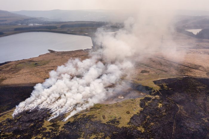
Wildfires might not be the first thing people associate with the Welsh Valleys, but in recent years, they have become a serious and growing concern. South Central Wales has experienced frequent and sometimes intense wildfires, putting both the natural environment and local communities at risk.
 whitcomberd/stock.adobe.com
To address this, Natural Resources Wales (NRW), the Welsh Government’s environmental body, commissioned gi Perspective to carry out a wildfire risk analysis for the region. The objective was to create a detailed, data-driven risk index that could help identify the areas most vulnerable to wildfire and guide more effective intervention efforts.
A Geospatial Approach to a Natural Threat
The project was delivered in collaboration with the Healthy Hillsides initiative. This partnership brings together agencies working to reduce the frequency and severity of wildfires in the South Wales Valleys through better land and resource management. Our role was to provide the geospatial intelligence to support those efforts.
We began by developing a structured plan, covering all stages of the project. This included stakeholder engagement, data discovery, model development, and a review process to refine our outputs. The strength of any spatial model lies in the quality of its data inputs, so particular attention was given to the accuracy and reliability of key datasets.
One of the most important datasets was vegetation habitat information, which indicates the types of fuel available across the landscape. We spent significant time improving this data to ensure that the model accurately represented fuel conditions. Using QGIS, we created a high-resolution raster model, assigning wildfire risk scores to each 25-by-25-metre cell across the study area. These scores were based on three factors: ignition likelihood, potential for fire spread, and the possible impact if a fire were to occur.
Building the Model with Local Expertise
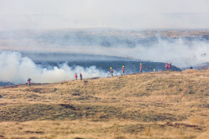
Once the initial model was complete, we shared it with project stakeholders, including local fire services. Their feedback helped refine the outputs and ensured the model reflected real-world experience. This collaboration was essential to validate the results and make adjustments where local knowledge suggested higher or lower levels of concern.

whitcomberd/stock.adobe.com
Through this process, we identified three core datasets that were most influential in assessing wildfire risk. These were historical wildfire ignition points, habitat types, and proximity to buildings. Other factors, such as slope, public access, infrastructure, and social deprivation, were also included in the model but carried lower weightings based on statistical and stakeholder input.
Delivering Meaningful Results
The final wildfire risk outputs were delivered as both GIS layers and printable maps. These products made it easy for stakeholders to visualise risk levels and focus their efforts on areas where prevention and preparedness would have the greatest impact.
Our method provided an efficient and practical alternative to more complex wildfire simulation tools. It allowed agencies without access to specialist fire modelling software to still benefit from robust spatial analysis and clear visualisations. Early feedback from several fire stations confirmed that the results aligned well with local knowledge of high-risk areas, helping build confidence in the model’s accuracy.
Using GIS to Make a Difference
whitcomberd/stock.adobe.com
This project demonstrates the power of GIS to support environmental resilience. By combining high-quality spatial data, local insight, and thoughtful modelling, we were able to create a tool that will help inform real-world decisions and reduce wildfire risks in the South Wales Valleys.
As climate pressures continue to reshape the UK’s natural landscape, tools like this will become even more essential. For organisations working in land management, emergency planning, or environmental protection, spatial analysis offers a powerful way to turn data into action.
If you would like to explore how GIS can support your work, we would be happy to help.
Comments are closed here.