General Bathymetric Chart of the Oceans (GEBCO)
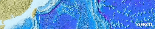
The General Bathymetric Chart of the Oceans (GEBCO) is a set of publicly available bathymetric data sets for the world’s oceans.
The current gridded dataset is a global Digital Terrain Model (DTM) covering both ocean and land at a resolution of 15 arc-seconds. It can be used for small-scale GIS analysis and to create regional maps of ocean depth.
Experts in Geographic Information Systems
gi Perspective provides organisations of all shapes and sizes with geographic information and digital mapping solutions, utilising our staff's breadth of experience to exceed customer expectations.
See our GIS Services